Underwater Photogrammetry Techniques: Mapping the Unexplored
Photogrammetry is a technique used to create accurate 3D models and maps using photographs. It involves capturing multiple images of an object or environment from different angles and using software to analyze the images and create a detailed representation. This process allows for the accurate measurement and documentation of various objects and environments.
Mapping underwater environments is crucial for understanding and preserving the marine ecosystem. Underwater areas are often inaccessible and pose unique challenges for mapping and exploration. Traditional mapping methods such as sonar and satellite imagery have limitations in terms of accuracy and resolution. This is where underwater photogrammetry comes into play.
Underwater photogrammetry is a specialized application of photogrammetry that is specifically designed to map underwater environments. It uses calibrated cameras and specialized techniques to capture high-resolution images of underwater objects and generate accurate 3D models. This technique has various applications in fields such as archaeology, marine biology, oceanographic research, and exploration of shipwrecks and submerged structures.
By using underwater photogrammetry, researchers and scientists are able to explore and document underwater environments in unprecedented detail. This not only helps in understanding the marine ecosystem but also aids in the preservation of underwater cultural heritage sites. The accurate 3D models created through photogrammetry provide a valuable resource for further study and analysis.
In the following sections, we will explore the challenges faced in underwater photogrammetry, the basic principles involved in the technique, different types of underwater photogrammetry techniques, various applications of the technique, successful case studies, current and future trends, and the potential of underwater photogrammetry.
Table of Contents
Challenges of Underwater Photogrammetry
Underwater mapping has always presented unique challenges due to the hostile and dynamic nature of aquatic environments. Traditional methods of mapping underwater environments, such as manual surveys or sonar-based techniques, are often time-consuming, expensive, and provide limited detail.
However, underwater photogrammetry has emerged as a revolutionary technique that overcomes these challenges. By utilizing a combination of high-resolution underwater cameras and specialized software, photogrammetry allows for the creation of accurate and detailed 3D models of underwater landscapes.
One of the main limitations of traditional underwater mapping methods is the lack of visual data. Sonar-based methods, while effective in detecting large underwater structures, often fail to capture the intricate details required for comprehensive mapping. Underwater photogrammetry solves this issue by capturing high-resolution images of the underwater environment, capturing every minute detail and preserving visual data for analysis and exploration.
In addition to the scarcity of visual data, underwater environments pose numerous unique difficulties. These challenges include inconsistent lighting conditions, limited visibility, and the need for specialized equipment to endure high pressure and corrosive saltwater. Underwater photogrammetry tackles these difficulties head-on by employing advanced imaging techniques and using calibrated cameras that account for the various environmental factors encountered in underwater settings.
Furthermore, underwater photogrammetry also relies on advanced algorithms and software to stitch together images, align them accurately, and reconstruct the 3D models. This process requires immense computational power and can be time-consuming. To overcome these challenges, researchers and developers are constantly exploring new methods to optimize algorithms and streamline the photogrammetric process.
In summary, traditional underwater mapping methods are limited by their inability to capture detailed visual data and the unique difficulties presented by underwater environments. Underwater photogrammetry offers a solution to these challenges by capturing high-resolution images, utilizing calibrated cameras, and employing advanced algorithms. Through its ability to create accurate and immersive 3D models, underwater photogrammetry is revolutionizing fields such as marine biology, archaeology, and oceanographic research, opening up new possibilities for understanding and exploring uncharted territories beneath the waves.
Basic Principles of Underwater Photogrammetry
Underwater photogrammetry is a powerful technique used to map and explore the unexplored underwater environments. It involves capturing images underwater and utilizing them to create accurate 3D models of the underwater terrain. This section will discuss the basic principles of underwater photogrammetry, including the process of capturing underwater images, the importance of using calibrated cameras, and the key steps involved in creating 3D models from these images.
Process of Capturing Underwater Images for Photogrammetry
To capture images underwater, specialized cameras and equipment are required. Underwater cameras are designed to withstand the harsh conditions and low light levels found in underwater environments. These cameras often have housing or casings to protect them from water pressure and provide clear visibility for capturing images. In addition, proper lighting is crucial for obtaining high-quality images underwater, as the lack of natural light can result in dark and blurry images. Therefore, photographers often use underwater strobes or artificial lighting sources to illuminate the subjects.
Importance of Using Calibrated Cameras
The use of calibrated cameras is essential in underwater photogrammetry. Calibration ensures that the camera’s internal parameters, such as focal length and distortion, are accurately measured and taken into account during the image processing stage. This allows for more precise reconstruction of the underwater scene and improves the accuracy of the resulting 3D models. Calibrated cameras also help in image alignment and reducing the errors introduced by lens distortion, which can affect the accuracy of the final models.
Key Steps Involved in Creating 3D Models from Images
The process of creating 3D models from underwater images involves several key steps. First, the images captured underwater are imported into a photogrammetry software, such as Agisoft Metashape or Pix4Dmapper. Then, the software automatically matches corresponding features in the images to determine their spatial relationship and position in 3D space. Once the images are matched, the software triangulates the camera positions and reconstructs the 3D geometry of the scene using techniques such as structure from motion or multi-view stereo. Finally, the software generates a dense point cloud representing the 3D surface of the underwater environment.
In conclusion, capturing underwater images for photogrammetry involves using specialized cameras and lighting equipment. The importance of using calibrated cameras cannot be overstated, as it ensures accurate measurement and reduces errors introduced by lens distortion. The process of creating 3D models from these images includes steps such as image matching, triangulation, and point cloud generation. By understanding these basic principles, researchers and explorers can effectively utilize underwater photogrammetry to map and explore the unexplored underwater world.
Types of Underwater Photogrammetry Techniques
Structure from Motion (SfM)
Underwater photogrammetry utilizes different techniques to create accurate 3D models. One of these techniques is Structure from Motion (SfM). SfM works by capturing a series of overlapping images of the underwater environment using calibrated cameras. These images are then analyzed to identify common features and calculate their positions in 3D space. The advantages of using SfM in underwater photogrammetry include its ability to reconstruct complex structures and its suitability for large-scale mapping projects. However, it also has limitations, such as the need for accurate camera calibration and the potential for errors in image registration due to underwater distortions.
Multi-view Stereo (MVS)
Another technique commonly employed in underwater photogrammetry is Multi-view Stereo (MVS). This technique involves capturing multiple images of the same scene from different viewpoints and using them to create a detailed 3D model. Underwater MVS works similarly to its terrestrial counterpart, with the main difference being the presence of water. Despite this, MVS still offers several advantages for underwater mapping, including its ability to handle scenes with varying lighting conditions and its suitability for capturing fine details. However, it also has limitations, such as the potential for errors in image matching and the increased computational requirements for processing large datasets.
Hybrid Methods
In addition to SfM and MVS, underwater photogrammetry can also benefit from the use of hybrid methods. These methods involve combining the strengths of both SfM and MVS to achieve more accurate and reliable results. By using SfM to establish an initial 3D point cloud and then refining it with MVS techniques, hybrid methods can provide a more comprehensive representation of the underwater environment. The benefits of using hybrid methods in underwater photogrammetry include improved accuracy, robustness to difficult conditions, and the ability to handle large-scale projects. Additionally, hybrid methods also help overcome the limitations of individual techniques, resulting in higher-quality 3D models.
Overall, underwater photogrammetry encompasses various techniques such as SfM, MVS, and hybrid methods. Each technique has its advantages and limitations, but when utilized in combination, they can offer comprehensive and accurate mapping solutions for underwater environments. Understanding these techniques and their applications is crucial for successfully exploring and mapping the unexplored underwater world.
Applications of Underwater Photogrammetry
1. Archaeology and Cultural Heritage
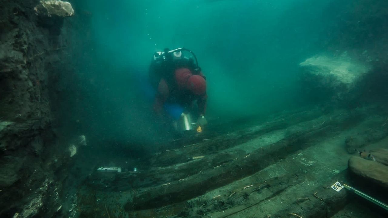
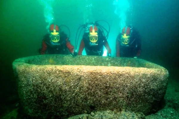
Underwater photogrammetry has revolutionized the field of archaeology and cultural heritage preservation. By utilizing this technique, researchers can create precise and detailed 3D models of submerged archaeological sites, such as ancient cities, sunken ships, and artifacts. These models provide a comprehensive documentation of the site, allowing for further analysis and virtual exploration. Archaeologists can accurately measure and study the dimensions of the structures, examine intricate details of the artifacts, and gain a deeper understanding of the history and cultural significance of the site. Additionally, these 3D models serve as valuable resources for education and public engagement, as they allow people to virtually explore and interact with these underwater archaeological wonders.
2. Marine Biology and Ecology
Marine biologists and ecologists also benefit greatly from underwater photogrammetry techniques. Through the creation of detailed 3D models, scientists can accurately measure and monitor marine organisms and their habitats. By examining the models, they can study the growth patterns of coral reefs, analyze the behavior of marine species, and evaluate the impact of environmental changes on underwater ecosystems. Marine biologists can gain insights into the biodiversity and health of marine habitats, enabling them to make informed conservation efforts.
3. Oceanographic Research
Underwater photogrammetry plays a crucial role in oceanographic research, allowing scientists to understand and map the complex dynamics of the ocean floor and its geological features. By using this technique, researchers can create high-resolution bathymetric maps, enabling them to identify underwater landforms, study underwater volcanic activity, and investigate the effects of tectonic plate movements. These detailed maps are invaluable tools for oceanographers to understand the processes shaping the ocean floor and to gain insights into oceanic circulation patterns.
4. Exploration of Shipwrecks and Submerged Structures
The exploration and documentation of shipwrecks and submerged structures have long fascinated researchers and history enthusiasts. Underwater photogrammetry provides an effective means to capture and preserve these sites in their entirety. By creating detailed 3D models, explorers can virtually explore the interior and exterior of these shipwrecks without physically disturbing them. These models not only assist in the identification and dating of shipwrecks but also preserve their cultural and historical significance for future generations.
In conclusion, underwater photogrammetry techniques have revolutionized various fields by providing detailed and accurate 3D models of underwater environments. From archaeology and cultural heritage preservation to marine biology and ecology, oceanographic research, and the exploration of shipwrecks, this technology has expanded our knowledge and understanding of the underwater world. As advancements continue to be made, it is essential that we embrace and further explore the potential of underwater photogrammetry in various other applications as well.
Case Studies
Highlight successful underwater photogrammetry projects
Throughout the years, there have been several successful projects that have employed underwater photogrammetry techniques for mapping and exploring unexplored underwater environments. These projects have revolutionized various fields of study, providing valuable insights and discoveries. One noteworthy project is the mapping of an ancient shipwreck in the Mediterranean Sea. Through the use of underwater photogrammetry, archaeologists were able to accurately recreate the ship’s structure and create detailed 3D models. This not only allowed for a better understanding of the ship’s construction and historical significance but also facilitated the preservation of the wreck.
Discuss the impact of these projects on various fields of study
The impact of these underwater photogrammetry projects extends beyond archaeology. They have also significantly influenced fields such as marine biology, ecology, and oceanographic research. By capturing detailed images of underwater ecosystems and marine habitats, researchers have been able to analyze and document the biodiversity and health of these environments. This information is crucial for conservation efforts and understanding the impact of human activities on marine ecosystems.
Provide visual examples of 3D models created using underwater photogrammetry
The use of underwater photogrammetry has resulted in stunning visual representations of underwater landscapes and structures. For example, using this technique, scientists have been able to create highly accurate 3D models of coral reefs, providing a detailed view of their structure and enabling further study of the organisms that inhabit them. Apart from coral reefs, submerged structures such as ancient ruins and shipwrecks have also been meticulously captured and transformed into visually immersive 3D models using photogrammetry. These models allow researchers and enthusiasts alike to explore these underwater sites without physically being there.
In conclusion, the application of underwater photogrammetry has had a significant impact on various fields of study. The ability to accurately map and create 3D models of underwater environments has opened up new avenues for research and exploration. From archaeology to marine biology, the use of photogrammetry has provided valuable insights into the underwater world. With further advancements in technology and techniques, the potential for underwater photogrammetry is limitless. It is an exciting field that promises to continue pushing the boundaries of our understanding of the unexplored depths.
Current and Future Trends in Underwater Photogrammetry
Advancements in Technology and Equipment
The field of underwater photogrammetry has witnessed significant advancements in both technology and equipment in recent years. These advancements have greatly enhanced the accuracy and efficiency of mapping underwater environments. High-resolution cameras that are specifically designed for underwater use have become more readily available, allowing researchers and professionals to capture detailed images of underwater structures and landscapes. Additionally, remotely operated vehicles (ROVs) and autonomous underwater vehicles (AUVs) equipped with sophisticated imaging systems have made it easier to collect data from deeper and more inaccessible areas.
Integration of Artificial Intelligence and Machine Learning
Artificial intelligence (AI) and machine learning (ML) are revolutionizing the field of underwater photogrammetry. These technologies are being utilized to develop automated image processing algorithms that can quickly and accurately analyze large sets of underwater images. By leveraging AI and ML, researchers and professionals can significantly reduce manual labor and improve the efficiency of creating 3D models from images. These advanced algorithms can automatically detect and match features in images, estimate camera poses, and generate highly detailed and precise 3D models.
Potential Future Applications and Developments
The future of underwater photogrammetry holds immense potential for various applications and developments. One exciting area of exploration is the use of underwater drones equipped with photogrammetry systems. These drones can navigate through underwater environments independently, collecting data and capturing images along the way. The integration of real-time data processing capabilities in underwater photogrammetry systems is another promising development. This would allow researchers to instantly generate 3D models while underwater, providing valuable insights for real-time decision making in fields such as marine biology, archaeology, and oceanographic research.
Another area of future development in underwater photogrammetry is multi-sensor integration. By combining data from different sources, such as sonar, LiDAR, and underwater photogrammetry, researchers can create more comprehensive and detailed maps of underwater environments. This integration of multiple sensors will enhance the accuracy and resolution of the captured data, opening up new possibilities for studying and understanding underwater ecosystems and structures.
In conclusion, the current trends in underwater photogrammetry are focused on advancements in technology and equipment, the integration of artificial intelligence and machine learning, and the exploration of potential future applications and developments. These advancements promise to revolutionize the field and enable researchers and professionals to overcome the challenges of mapping the unexplored underwater world. The continuous evolution of underwater photogrammetry will undoubtedly contribute to further scientific discoveries, conservation efforts, and the exploration of underwater environments for years to come.
Conclusion
As we conclude this article on underwater photogrammetry techniques for mapping the unexplored, it is important to recap the numerous benefits and immense potential of this innovative approach.
Underwater photogrammetry offers a revolutionary way to explore and understand underwater environments, whether it be for scientific research, archaeological discoveries, or ecological studies. By utilizing calibrated cameras and capturing a series of images, this technique enables the creation of precise and detailed 3D models of submerged structures and landscapes.
One of the greatest advantages of underwater photogrammetry is its ability to overcome the limitations of traditional mapping methods. It provides a cost-effective and time-efficient solution, minimizing the need for expensive and cumbersome equipment. Additionally, with advancements in technology and the integration of artificial intelligence and machine learning, the accuracy and efficiency of underwater photogrammetry are continuously improving.
Furthermore, underwater photogrammetry finds applications in a wide range of fields. It plays a crucial role in archaeology and cultural heritage preservation, allowing researchers to document and analyze underwater archaeological sites with unparalleled precision. It also contributes to marine biology and ecology, aiding in the study and conservation of underwater ecosystems. Moreover, oceanographic research benefits from the ability to map the seafloor and observe underwater phenomena accurately. Not to mention, the exploration of shipwrecks and submerged structures has been greatly enhanced by underwater photogrammetry, providing valuable insights into historical events and maritime history.
In conclusion, underwater photogrammetry represents an exciting and promising frontier in the field of underwater exploration. Its multifaceted benefits reach far beyond research and have the potential to revolutionize the way we understand and interact with the underwater world. As this technology continues to evolve, we encourage further exploration and adoption of underwater photogrammetry to unlock its full potential and expand our knowledge of the unexplored depths.

